
Classification : Natura 2000, ZNIEFF1-ZNIEFF2, Geosite of UNESCO World Park
Managing Organization : Conservatory of Natural Areas Rhône Alpes, Community of Municipalities
Presentation :
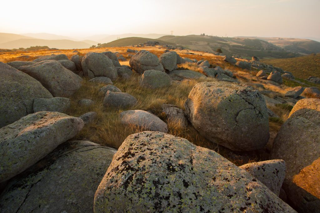
Montselgues is characterized by a base essentially made up of porphyroid granites (formed around – 300Ma and characteristic of the Borne granites) which play an important role in the various geological formations observable on this portion of the Park.
The chaos of Montselgues are granitic chaos, located northeast of the town of Montselgues, in the localities of Serre de la Dame, Genest, Les Rancs and Le Petit-Paris. They were formed by the combined action of two phenomena : first, the fracturing of the basement during tectonic constraints (alpine and Pyrenean orogeny, opening of the Alès ditch); then, an alteration of the rock by infiltration of water in the networks of cracks and in the crystals (feldspar and micas) which leads to the breaking of the bonds in the minerals and between the blocks causing a weakening of the whole. The rocks then transform into sands (arenas) which surround the unaltered parts remaining in the form of balls.
These chaos constitute a part of the Montselgues plateau which corresponds to an antetriassic peneplain. This plateau is spread over a north-south axis, bordered to the west by the Borne and to the east by the Thines stream. Its base is composed of porphyroid granites (the same as those which form chaos) formed in the primary era (around – 300Ma). After a period of intense erosion which leveled the reliefs at the end of the primary era, sandstones are deposited at the beginning of the secondary era during the Triassic, in essentially continental regime (fluvial and deltaic). These sandstones constitute layers of about ten meters thick, slightly inclined towards the south and the west.
They are mainly arkose coarse-grained sandstones characterized by an often siliceous cement rich in iron oxide (hence a pink, reddish coloration). But it is also possible to observe in places, some wrinkles of fossil current which testify to old beaches.
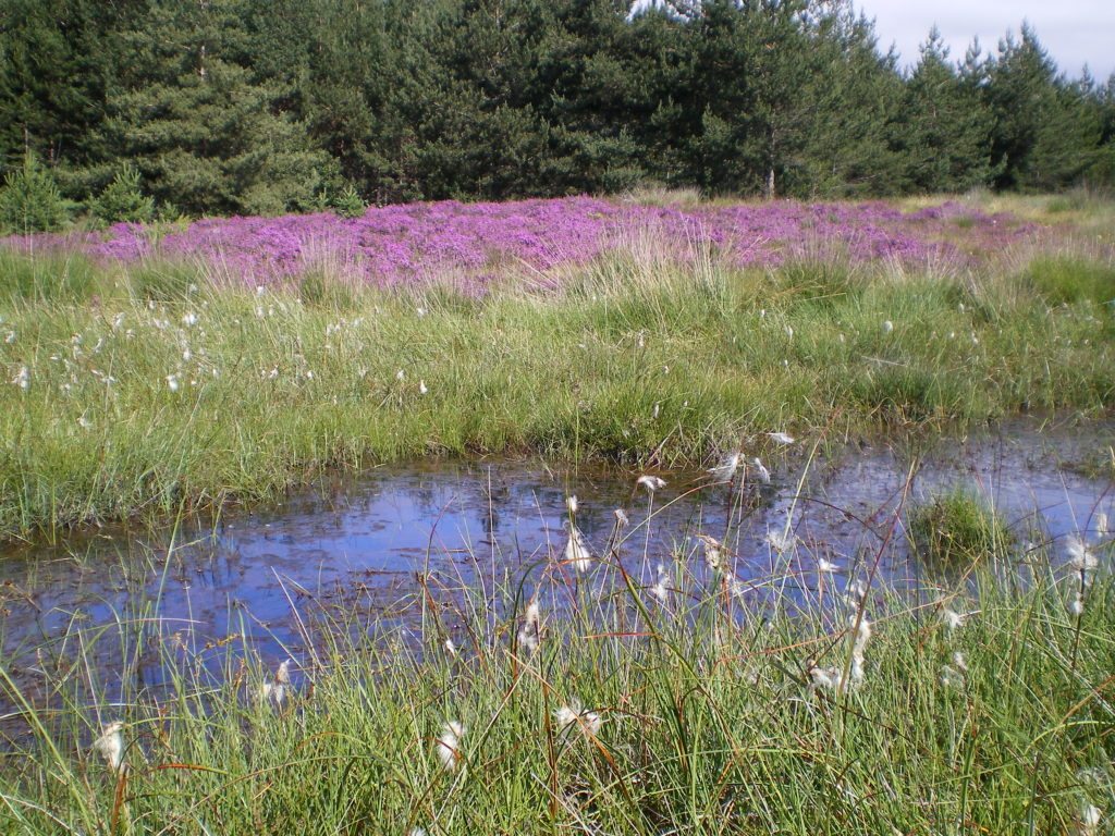
The superposition of rocks (sandstone on base) is favorable to the formation of springs and peat bogs. Indeed, at the point of contact between the basement and the sandstones (at around 950 meters above sea level), the seepage water is stopped because of the lower permeability of the granites, while the porosity of the sandstones favors rainwater storage sometimes corresponding to reserves of several years. Sources that feed the peat bogs then form at the point of contact between the basement and the sandstones.
The presence of these peatlands is mainly explained by two converging phenomena : source areas and anthropogenic developments. This diversity of environments, some of which are recognized as remarkable on a European scale, offers as many areas of life, reproduction and hunting for many species of flora and fauna (peat bog lycopod, viviparous lizard, white rhynchospora, sundew with round leaves, etc.).
Scientific or educational interests :
The Montselgues plateau is considered by some geomorphologists as “the most beautiful European example, perfectly preserved, of such an ancient surface of erosion”. The theme of erosion fits particularly well to the studies on the Montselgues site, through granitic chaos and by evoking the formation of the Montselgues plateau : antetriassic peneplain formed by flattening the base on which rest the sandstones of the Triassic.
The presence of springs and peat bogs finally makes it possible to account for the differences in permeability between basement and Triassic sandstone.
Numerous scientific studies carried out since 1999 have made it possible to deepen knowledge and better understand the challenges of the site : vegetation mapping, hydrogeological functioning, biological exchanges and dispersion of insects, population dynamics of the viviparous lizard, study on the fallout of dust (palynology) linked to the exploitation of mines (in progress), study concerning the links between wetlands and groundwater (in progress), study on the built heritage and past uses of water,…
The implementation of management plans has made it possible to experiment several techniques for restoring peatlands and keeping open environments : grinding, slashing and burning, woodcutting, drain plugging, pastoral management, etc.
In parallel and in order to assess the effectiveness of the conservation actions implemented, several follow-ups are carried out : meteorological, piezometric, hydrological, Rhomeo protocol, etc.
The peatlands of the plateau are emblematic of the success of a global and functional approach to the challenges of wetlands. The municipality of
Montselgues was able to base its economic development on a project to preserve biodiversity through agriculture and tourism. The project has been promoted in various communication media (conferences, films). This particular case must be able to adapt to other economic and geographic contexts.
Thematic key words : agro-ecology, agronomy, biology, botany, woodcutting, cartography, climatology, ecology, entomology, study of fauna, forest, geography, sedimentary geology, geomorphology, hydrogeology, hydrology, impact on tourist numbers, ornithology, paleoclimatology, palynology, pastoralism, landscapes, pedology, invasive plants, 3D digitization topology, territorial sciences.
Keywords typology of sites : panorama reading landscapes, agricultural or pastoral zone, peat bogs, mediation space.
Access modalities :
Free access all year round
Possible support : By the mediators of Fage, by a Natura 2000 facilitator – NSA from the Community of Municipalities, by a member of the Scientific Committee of the UNESCO Global Geopark.